road trip

adventuraadventureAmericaLifestyleNational Parksphotographyroad triptraveltripsturismoUnited StateutahVacations

A QUICK STOP AT KANARRA FALLS

IMG_4879

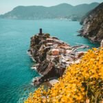
I closed my eyes for a couple of minutes. All I could hear was the sound of the water flowing in the river. I was at a higher plane of tranquility, under a spell. The city noise was gone and this time it wasn’t my sleep machine or my YouTube audios for meditation. 

It was real, and as soon I approached the mountains, the sound became more intense, as much as the birds tweeting while they were escorting me in this hiking. What a charming moment! 

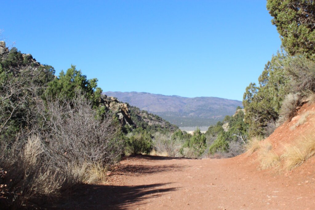
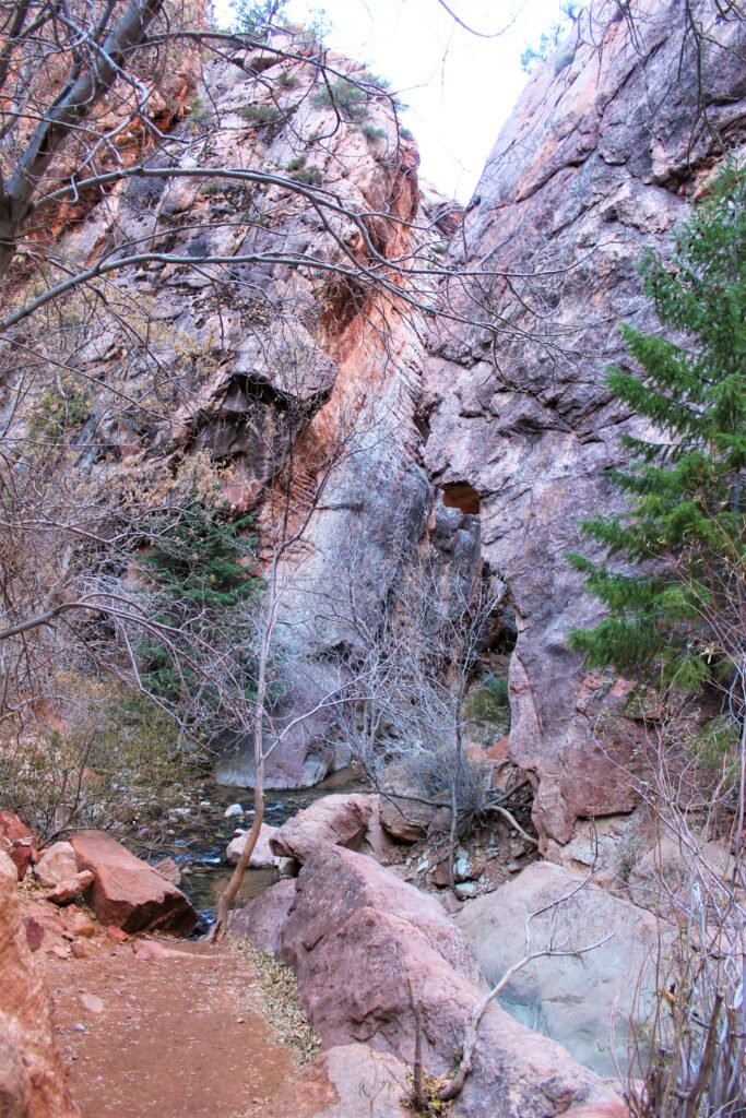
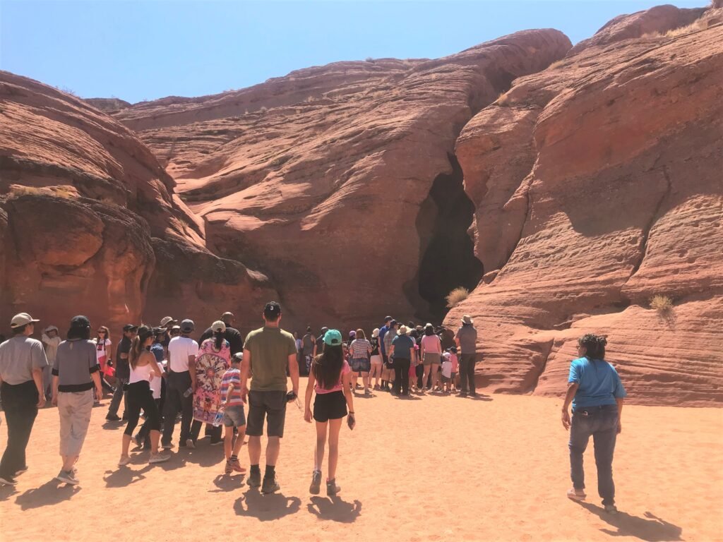
My friend and I were alone in the middle of this fascinating environment surrounded by big, red sandstones canyons and creeks. While our way narrowed, the view was becoming more stunning without the sun incandescence. It’s was the best time to recharge those energies. 

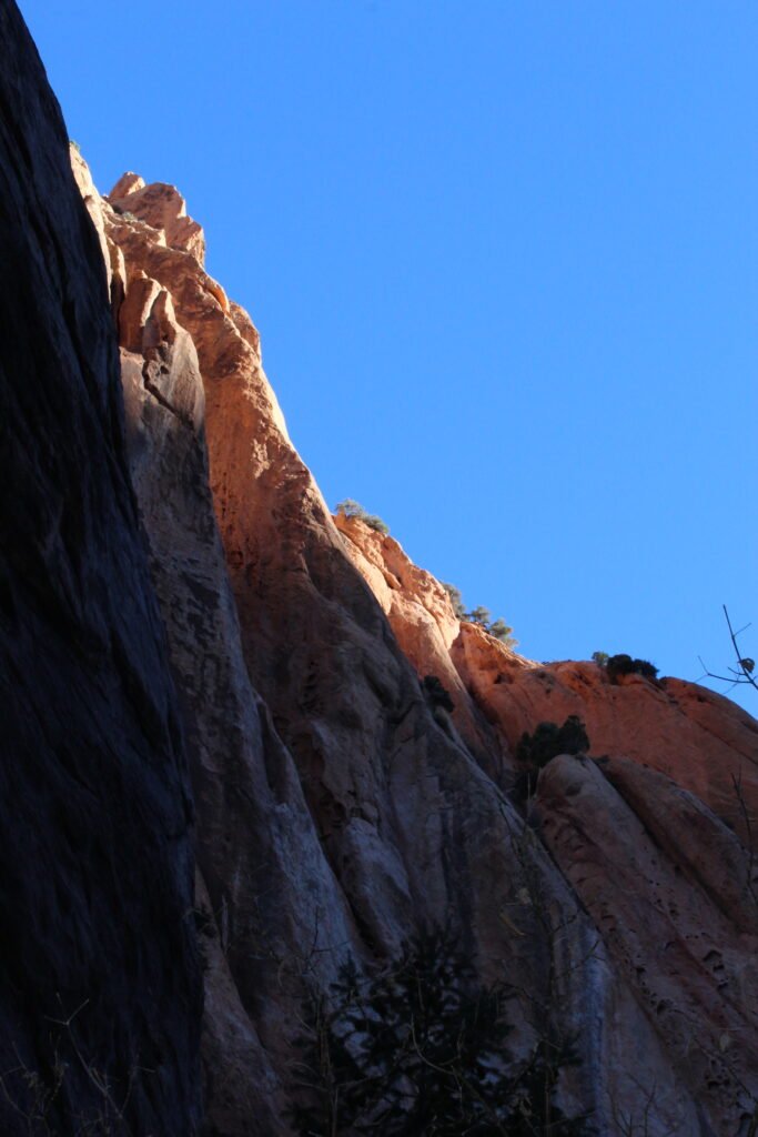
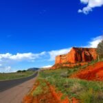
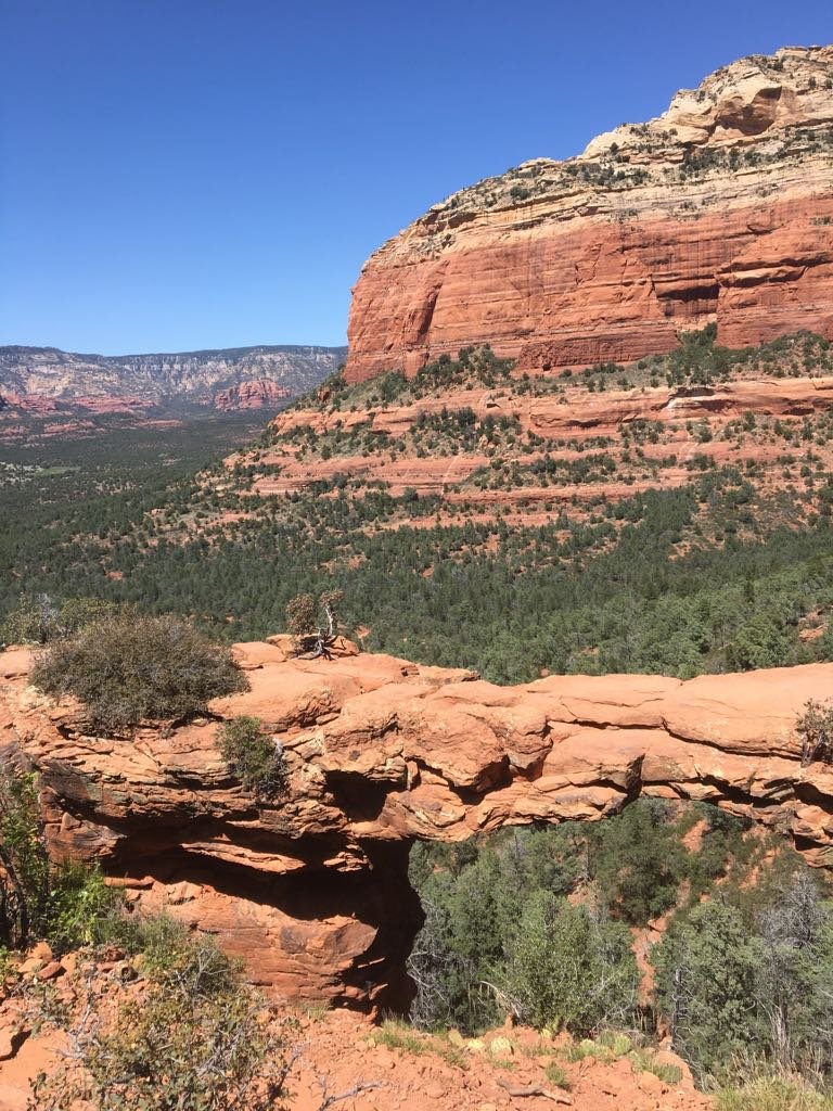
This incredible connection with mother nature happened in Kanarra falls, near the Zion National Park, in Utah (Western US). The State is well known for its amazing rock formations resembling the surface of Mars. 

How to get there? 

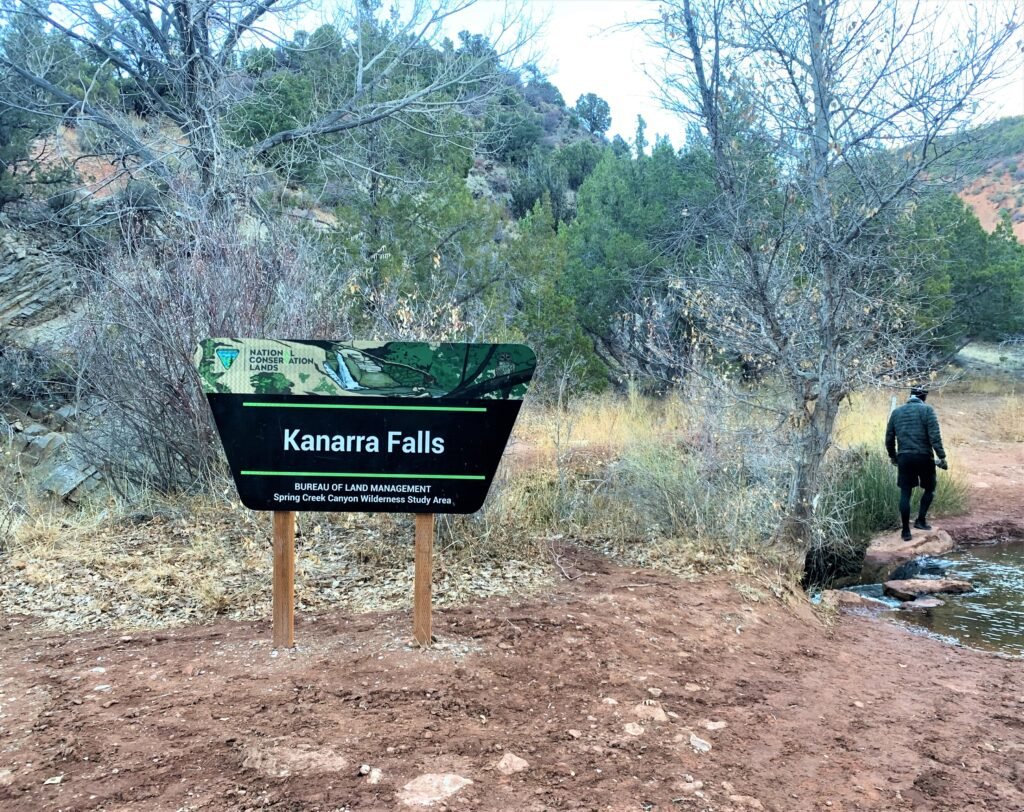
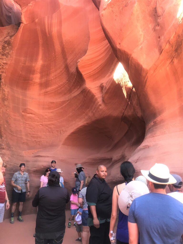
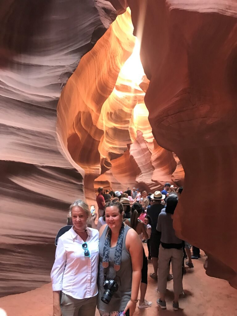
Kanarra Falls is becoming the new place for adventure seekers because of its short paths, the similarity with Antelope Canyon plus a creek, and the gorgeous and thoroughly photographed waterfalls. It’s the perfect route to add to your itinerary inside Utah National Parks. 

November was ending, and my friend and I were driving cross-country from Los Angeles to New York City. That day, we left Las Vegas at 5am. After 2 hours and a half driving, we made a quick stop in Kanarra Falls, and without planning, took this adventure. And why not? 

Driving from Las Vegas is one of the options to get there. Driving from Salt Lake City takes 4 hours and a half. But the easiest option is staying in St. George (1 hour away) or Cedar City, being the closest towns (15 minutes). 

What to pack?  

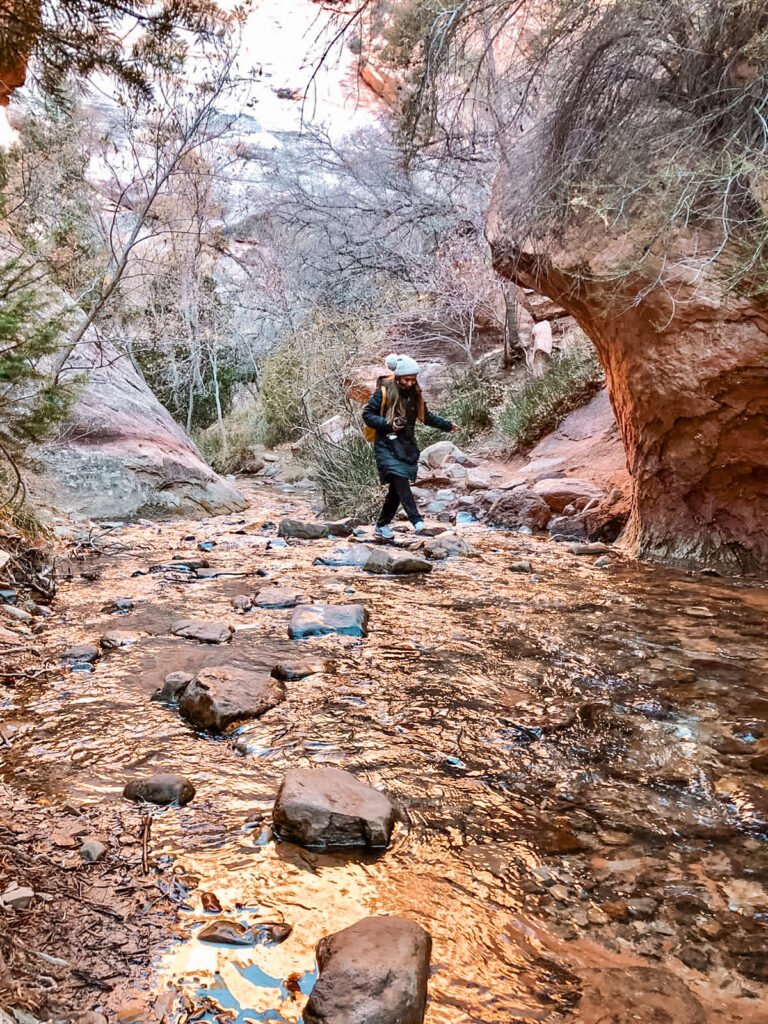
Waterproof shoes or waterproof hiking boots with wool socks are highly recommended. Especially in Fall and Spring when the water is frozen, and the last point of the route is through the creek. 

I decided to take this trip on a whim, without considering my outfit. Big mistake! My friend had the proper shoes. Instead, I wore white sneakers (that ended up all muddy.) and as much as I grabbed the riverbanks or skipped from rock to rock, at some points there wasn’t any other option than to cross through the cold river at some spots.  

In any case, the water never got deeper than the ankle height until the first waterfall.

Also, it’s important to pack a drybag, a water bottle, and sunblock. The trekking poles are optional for balance. 
 

The trail  

Kanarra Falls is a moderate and short walk. Ideal for families. It takes 2 hours –out and back- until the first waterfall (the one with best view) and up to 3 hours to the third one.  

The first part of the trail is flat, then with a little bit of climbing and some jumping between rocks. There are not trail signs but, it’s not complicated to see and follow the path. 

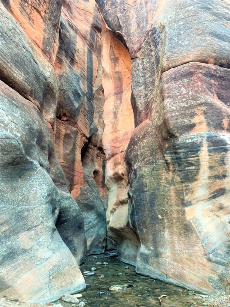
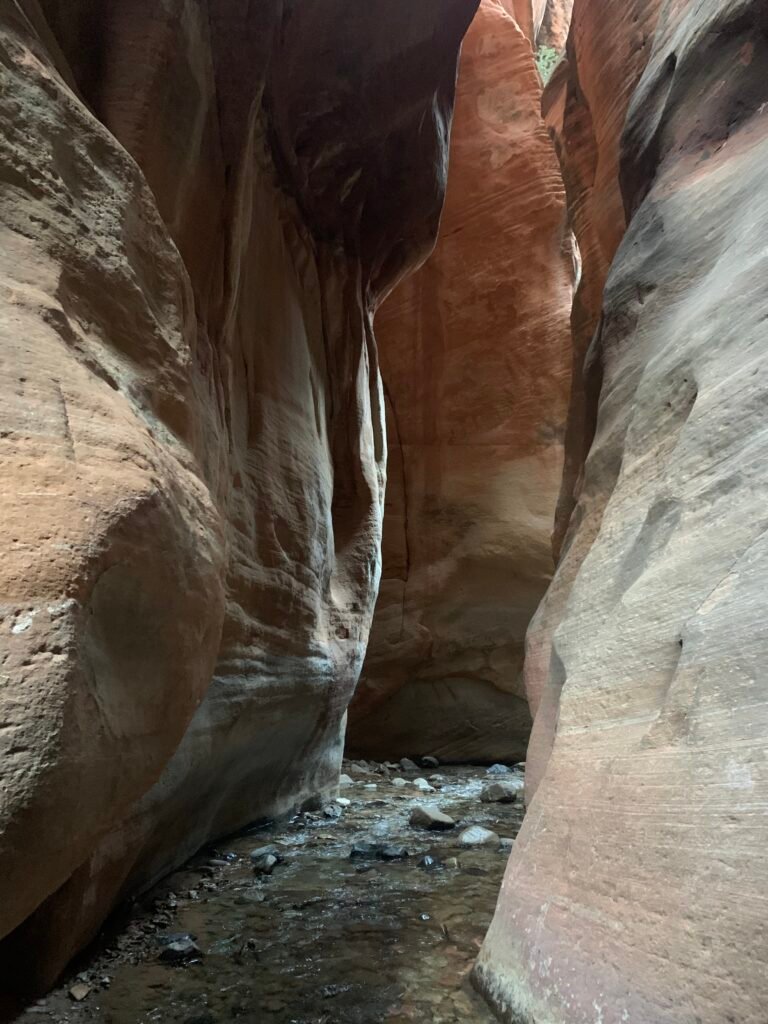
Once we entered the Slot canyon, it just took my breath away. The dramatic natural carvings, the rich and striking colors, as well as the marvelous light beams bouncing and reflecting off the towering stone walls were mesmerizing. 

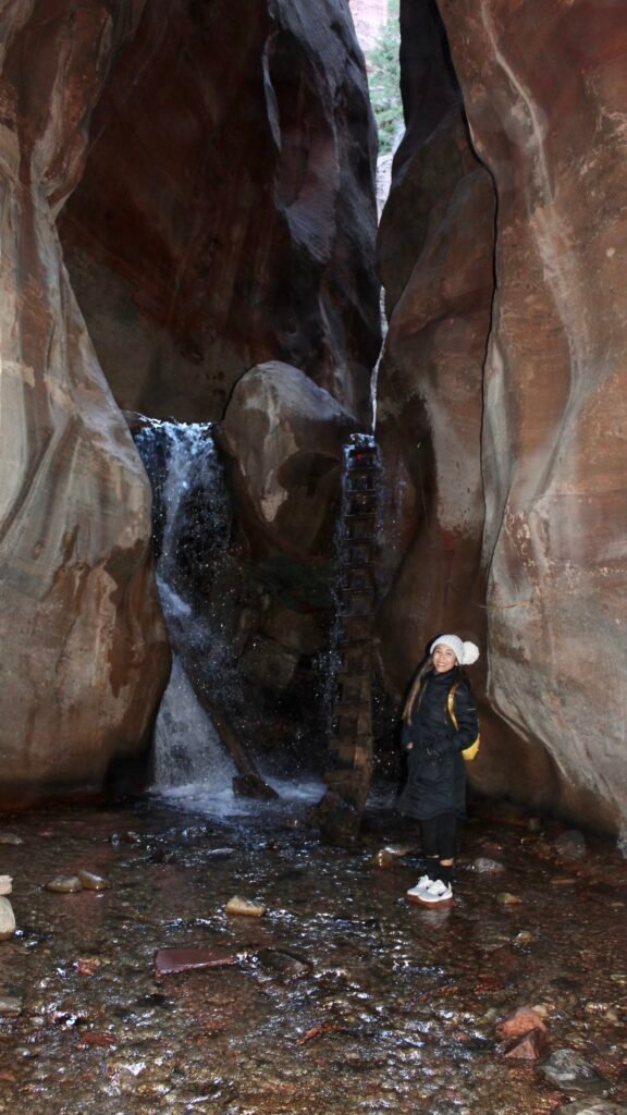
Inside the canyon, the waterfall, a metal ladder, and a tree trunk were the perfect frame for our first stop in Kanarra Falls. This was my Instagram’s moment. After the climb, comes the way to the other two waterfalls. 

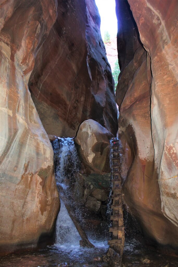
Once again, my inadequate shoes didn’t allow me to go forward. The ladder was too slippery, and the rope was deteriorated, so I didn’t want to take the risk of falling. Lesson learned!  

Nevertheless, I took some time to enjoy, connect and appreciate as much as I could from this amazing sight while my friend went forward first.  

Quick facts:    

·    The ticket cost 12 USD per person with parking included.  

·    Only 150 persons are allowed to enter per day. I recommended you to buy it before on their website www.kanarrafalls.com  

·    Pets are not allowed on the trail and it’s also not intended for kids under 6 years old. 

·    The best seasons are the Spring and Fall.   

·    There is a restroom just a bit after the trail begins, and at the parking lot. 

adventuraadventurephotographyroad tripSpanishtraveltripsturismoVacationsworldwide

Explorando Utah: Las cascadas de Kanarra

IMG_1074

Cerraba mis ojos y el sonido del agua cayendo sobre las rocas y fluyendo en su cauce, me relajaba y me deleitaba. Esta vez, no era mi máquina para dormir ni los audios de YouTube, que se escuchan para meditar. 

Sucedía en vivo y a medida que me acercaba a la montaña, su sonido era más intenso. Al igual que el canto de los pájaros que me acompañaban en mi caminata.  

Cuando abría mis ojos, en cambio, sobre mi resplandecía ese color naranja y rojizo del cañón que se imponía frente a mí.  

Mi amigo y yo estábamos solos en medio de la naturaleza. Mientras entrábamos al cañón por el arroyo y nuestro camino se estrechaba, el paisaje se volvía alucinante por la poca entrada de luz. Era el mejor momento para recargar energías. 

Esta conexión con la naturaleza ocurrió en las cascadas de Kanarra, cerca del Parque Nacional Zion, en el estado de Utah (el oeste de Estados Unidos), conocido por sus formaciones geológicas rocosas que evocan al planeta Marte.  

¿Cómo llegar?  

Las cascadas de Kanarra es la ruta de senderismo que se ha convertido en un nuevo destino, por ser una caminata corta, por su parecido al cañón del Antílope, pero con agua y por ser muy fotografiable. 

Era finales de noviembre y acompañaba a un amigo a manejar desde Los Ángeles hasta Nueva York (costa oeste a este). Salimos de Las Vegas a las 5am y casi tres horas después comenzamos la aventura.

La manera más fácil es llegar manejando desde Las Vegas (2 horas y media) o desde la ciudad de Salt Lake (cuatro horas y media). Otra opción es dormir en Cedar (a 15 minutos) o St. George, que son dos pueblos cercanos. Esta caminata es ideal y una parada estratégica si estás recorriendo el Gran Cañón, el Parque Nacional Zion, o el cañón Glen.

¿Qué empacar?  

Lo más importante y lo primero que hay que empacar: zapatos para agua, botas para caminatas o medias de lana que sean para excursión. En otoño y primavera, el agua es helada y parte del camino es sobre el río.  

Por viajar sin mucha planificación, andaba con zapatos deportivos blancos (que volvieron llenos de lodo y arcilla) y por más que cruzaba lentamente pisando las piedras o saltando entre los cauces hubo un punto donde no tenía otra opción que mojarme y congelarme.  En cambio, mi amigo estaba preparado.

En verano incluso se puede llevar traje de baño… Obvio, incluir agua y protector solar. 

La expedición  

La caminata es moderada y corta. La duración total es de 2 a 3 horas, pero depende si avanzas hasta la tercera cascada. Aunque la mejor vista la tiene la primera caída de agua.  Como la ruta de ida es la misma que la de retorno, son en total 5.4 kilómetros hacia el primer punto. ¿Fácil no?  

Al comienzo es plano, despué se sube por la colina, luego entre ramas, por las rocas y saltando riachuelos. El sendero no está señalizado, pero no es complicado ver la ruta. A medida que uno se acerca al cañón, el trayecto se estrecha y hay que adentrarse para poder ver la primera cascada.  

Las formaciones rocosas erosionadas, el color del cañón, la cascada, un tronco y una escalera de madera fueron el marco de la primera parada de Kanarras. Subiendo se llega a las otras dos estaciones, pero la mejor y la más fotografiable sin duda es esta.  

Mis zapatos inadecuados me impidieron seguir hacia la segunda cascada, pues la escalera era resbaladiza y el agua, heladísima. ¡Aprendí mi lección! Sin embargo, aproveché ese momento para deleitar mi vista y mantener ese contacto con la belleza natural que ofrece el estado de Utah. 

Datos:  

  • La entrada vale 12 USD por persona e incluye el parqueadero. Hay que reservarlas con anticipación en el sitio web www.kanarrafalls.com 
  • La caminata es limitada a 150 personas por día. No es recomendable para menores de 6 años. 
  • La mejor temporada es la primavera y el otoño.  
  • Las mascotas no están permitidas.  

bucketlistroad tripSpanishtraveltripsturismoUncategorizedutahworldwide

Por la autopista US 89: Utah y Arizona

IMG_8372

El Parque Nacional Zion resplandecía con sus colores rojizos, rosados, anaranjados y amarillos. Su paisaje rocoso y semidesértico era la puerta de entrada al estado de Utah, en el oeste de Estados Unidos. Al conducir, era como estar inmerso en un parque temático de la naturaleza.

Así fue como inicié mi travesía en carro “road trip” por el oeste del país. Luego de 10 años viviendo en Nueva York, era tiempo de explorar esos espectaculares parques nacionales, aún habitados por comunidades de  indios americanos. Manejando desde Las Vegas, Nevada y tomando la ruta 89, visité 4 sitios. Zion, Cañón del Antílope​​ (Antelope Canyon), la Curva de la Herradura (Horseshoe bend) y el Lago Powell.

IMG_8237
Springdale, es el pueblo más cercano al Parque Nacional de Zion

Imponentes muros, que forman parte del cañón; majestuosa topografía, colinas, desfiladeros, altos precipicios, miradores, riachuelos, lagos, estanques, pantanos, desierto… Eso es Zion. Si eres amante de la naturaleza y de acampar, recorrerlo completamente requerirá de al menos 5 días.

El parque tiene 15 senderos con caminatas fáciles, moderadas e intensas. Los buses gratuitos te llevan desde el parqueadero hasta el comienzo de cada trayecto. En mi caso elegí ‘Canyon Overlook’. Es el único lugar en el que puedes parquear el vehículo en un punto cercano.

IMG_8206

La experiencia es fascinante. Parte del camino es tallado sobre las piedra, hay abismos en los que debes agarrarte de la sogas y subidas sobre rocas. El calor de julio, intenso. Pero con agua, ropa cómoda y gorra llegarás en una hora al punto panorámico, donde las montañas se entrelazan y le dan forma al cañón.

‘Narrows’ es la más famosa y difícil porque caminas por el río Virgin y el trayecto es de 8 horas. En cambio, ‘Angels Landing’ es el “estrella”, apta para los que no sufren de vértigo. Por tiempo no pude completar otro sendero porque debía manejar tres horas hasta llegar al pueblo de Page, cercano a mi siguiente punto. Antílope.

Cañón del Antílope o ‘Antelope Canyon’

Ubicado dentro del desierto en el estado de Arizona, para los indios Navajos, Antílope es su sitio espiritual, en el que ellos sienten esa armonía con la naturaleza.

Este cañón, con curvaturas en sus paredes, es sin duda uno de los sitios más fotografiados y visitados del país. Debido a su delgadez, la luz que penetra a la roca arenisca le da unos tonos naranja, amarillo y rojo espectaculares.

IMG_8354(Edited)
El cañón alto tiene hasta 40 metros de altura.

Solo se puede ingresar con un tour dirigido por Los Navajos. La mejor hora por su luz, 12pm. Conseguir esos tickets, misión casi imposible. Hay que comprarlos con semanas de anticipación.

Con suerte conseguí para las 11am. Durante la espera, el calor, una vez más, era intenso. Luego una camioneta nos llevó  por una ruta de arena hasta el Antílope Alto, donde ya la marejada de turistas hacía línea para ingresar.

Adentro la atmósfera era única. Mágica. A medida que acercaba el mediodía, Antílope tenía una  fusión  de luces y sombras. En ciertos espacios era como estar dentro de la cueva. Tomarse fotos era desafiante por la cantidad de turistas y la estrechez del cañón. Y, se suma la forma del sitio porque no es circular.

Luego de una hora entre este fantástico juego de colores, la siguiente parada era a 15 minutos. La Curva de la Herradura (Horseshoe bend).

Mi favorito. La vista natural más espectacular de US. Es como un lienzo. La altura del cañón, Glen, y el perfecto meandro rodeado por el rio Colorado (400m. de altura), te erizará  la piel y te dejará sin aliento.

La ruta desde el parqueadero hasta el borde, es muy corta. 15 minutos. Pero, al ser desierto y con la temperatura de 42 grados, hay decenas de letreros aconsejando llevar mucha agua y protección solar. Y, tienen razón porque a los 5 minutos era difícil hasta respirar y caminar.

Una vez en el mirador, solo hay que disfrutar de la vista. Llenarse de energía y fotografiar cada rincón. Los más arriesgados se acercaban al limite para conseguir el retrato perfecto. La mejor hora. La caída del sol.

IMG_8375
IMG_8357

Una vez culminada esta travesía, regresaba a Las Vegas. Pero un letrero de entrada al Lago Powell captó mi atención. Decenas de carros-casa estaban parqueados a lo largo del lago artificial. Al ver el agua cristalina y con la temperatura tan alta, era imposible no sumergirse antes de regresar a Nevada.

IMG_8384
El lago Powell se ubica entre Arizona y Utah.

Datos:

  • La entrada a Zion es de 35 USD por vehículo. El pase dura hasta una semana.
  • No hay muchos pueblos cercanos. Las mejores opciones son Springdale (cerca de Zion) y Page ( Antílope).
  • Antílope tiene dos cañones. Alto y bajo. La mejor vista es el primero. La entrada vale 60USD adultos. 30USD niños. Solo se puede pagar en efectivo.
  • Los aeropuertos cercanos a estos sitios son el del Las Vegas, Nevadas y el de Phoenix, Arizona.
Americabucketlistroad triptraveltripsturismoutahworldwide

ON US ROUTE 89: UTAH AND ARIZONA

IMG_8372

Zion National Park was glowing with its reddish, pink, orange, and yellow hues. Its rocky and semi-desert landscape was the gateway to the state of Utah, in the United States. Driving through it felt like being immersed in a nature theme park. 

This is how I began my first road trip journey through the west of the country. After 10 years living in New York, it was about time to explore those spectacular national parks, still inhabited by American Indian communities. Driving from Las Vegas, Nevada, I went through Route 89, visiting 4 sites: Zion, Antelope Canyon, Horseshoe bend and Lake Powell. 

IMG_8237
Springdale, the closest town to Zion National Park

Imposing walls, which form the canyon, majestic topography, hills, gorges, high precipices, lookouts, streams, lakes, ponds, swamps, desert… All of it is Zion.  

If you are a lover of camping and nature, it will take you at least 5 days to explore it fully. The park has 15 trails with easy, moderate and intense walks. The free buses take you from the parking lot to the beginning of each journey. In my case I chose ‘Canyon Overlook’. It is the only location where you can park your vehicle at a nearby point. 

IMG_8206

The experience is fascinating. Part of the path is carved out of the stone, and there are chasms where you must hold onto the ropes and climb on rocks. The heat of July is intense, but with a water bottle, comfortable clothes and a cap, you will reach the panoramic viewpoint in an hour. This is where the mountains trails meet and shape the canyon.  

Narrows is the most famous and difficult because you walk along the Virgin River and the journey takes 8 hours. Angels Landing is the ideal for beginners, suitable for those who do not suffer from vertigo. Since I was running out of time, I couldn’t complete another trail. I had three hours ahead of me to reach the town of Page by car, near my next point: Antelope.  

Antelope Canyon

Antelope Canyon is located within the desert in the state of Arizona. For the Navajo communities, Antelope is a spiritual place, where you can feel in harmony with nature. This canyon, with dramatic curvatures in its walls, is undoubtedly one of the most photographed and visited sites in the country.

Because it’s such a narrow passage, the light that penetrates and bounces of the sandstone rock is reflected in a multitude of orange, yellow and red tones.

IMG_8354(Edited)

Only Navajo guided tours are available, and the best time for its light effect is at 12pm. Get those tickets early. It’s almost mission impossible, so plan to buy them weeks in advance.  

Fortunately, I got them for the 11 am tour. While I waited, the heat, once again, was getting to me. A van took us down a sandy route to the Upper Antelope, where we encountered a flood of tourists already lining up to enter. 

Inside, the atmosphere was more than unique. It was magical. As noon approached, Antelope gave us a display: a fusion of light and shadow. In certain parts, it was like being inside a cave. Taking photos was challenging due to the number of tourists and the confinement of the narrow canyon. The shape of the site is not helpful either. 

After an hour surrounded by this fantastic game of colors, we walked 15 minutes towards the next stop: Horseshoe bend  

Horseshoe bend

My favorite spot. Perhaps, the most spectacular natural view in the US. It is like a canvas: The height of the Glen canyon, and the perfect meander surrounded by the Colorado River (400m high), will take your breath away.

The route from the parking lot to the canyons edge is very short. Only 15 minutes. But this is the desert, and with an average temperature of 104 degrees, you will find dozens of signs advising you to bring plenty of water and sun protection. And believe me, they are right to warn you. After 5 minutes I found it difficult to breathe and walk at the same time.

Once in the observation point, you get to enjoy the view. Fill yourself with energy and photograph every corner. Some daring tourist approached the edge to get the perfect portrait for the hour: The sun falling in the sky. 

IMG_8375

Once I finished this adventure, I began my drive back to Las Vegas. But an entrance sign to Lake Powell caught my attention. Dozens of mobile homes were parked along the shores of the artificial lake that is the second largest man-made reservoir in the United States.

Seeing the crystal-clear waters while enduring the sweltering temperature, it was impossible for me not to make a final stop and take a dive before returning to Nevada. 

IMG_8384
Lake Powell is in the border of the states of Arizona y Utah.

To know:

  • Entry to Zion is $ 35 per vehicle. The pass lasts up to a week. 
  • There are not many nearby towns. The best options are the towns of Springdale (near Zion) and Page (Antelope). 
  • Antelope has two cannons. High and low. The best view is the first. The entrance is 60 USD for adults and 30 USD for children. You can only pay in cash. 
  • The airports near these sites are the ones serving Las Vegas, Nevada and Phoenix, Arizona 
en_USEnglish